-
-
-
-
-
-
Falmouth Historical Maps
-


Research - Falmouth Historical Maps
Here are links to maps that are helpful when researching the history of families or property in Falmouth. We provide links to digital copies hosted by major institutions because most of the maps are enormous. The full resolution digital maps are so large and in special formats that downloading and processing the entire map is impractical for many. Most researchers are interested in only a portion of the map. We suggest displaying the map in full screen mode and zooming in to obtain the most detail with the best clarity. Capture the displayed image by taking a "screen shot" for processing by any photo editing software.
A presentation given at Falmouth Memorial Library offers a guided tour to these maps:
| Maps |
|
Osher Map Library - Osher Atlas Collection This map is a companion to Willis' History of Portland. It portrays English settlement of Ancient Falmouth prior to 1690. |
 |
|
Osher Map Library - Osher Atlas Collection This map is a companion to Willis' History of Portland. It portrays grants by the Proprietors of Falmouth on Falmouth Neck (present-day Portland Peninsula) by 1728. Many early families in what is present-day Falmouth had homes or businesses on Falmouth Neck. This well-researched map shows where . |
 |
|
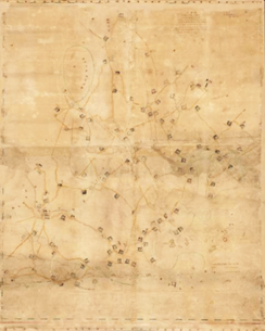
Osher Map Library - Sheet Map Collection - Maps at Falmouth Memorial Library This map is a companion to the Records of the Proprietors (three bound volumes and three small paper books) at the Cumberland County Registry of Deeds. The map portrays lots in the northern portion of Ancient Falmouth. It is the only detailed, contemporary map for the period. It is the vital "Rosetta stone" for making sense of early deeds. The map was expertly imaged but not digitally enhanced by Osher. Use of photo editing software will improve legibility. For more information, see FHS Presents-The Proprietors Map. |
 |
|
Small, John (1761) Osher Map Library |
 |
|
Greenleaf, S., Captain (1771) Library of Congress |
 |
|
Des Barres, Joseph F. W. (ca. 1775), London |
 |
|
Maine Memory Network - Map at Maine Historical Society |
 |
|
Noyes, Joseph (1794-5), submitted to the Massachusetts Secretary of State |
 |
|
Maine History Network - Map at Maine Historical Society This map is the product of a survey conducted to determine the cost of maintaining town roads in 1804. Subsequent changes appear to have been overlaid onto the original. The survey was probably completed using a compass and a chain marked off in rods and links. The roads should be fairly accurate. Houses were added to provided points of reference; their locations are, at best, approximate.
|
 |
|
Library of Congress |
 |
|
Osher Map Library - Sheet Map Collection - Maps at Falmouth Memorial Library This map is the product of a survey conducted to determine the cost of maintaining town roads in 1828. The survey was probably completed using a compass and a chain marked off in rods and links. The roads should be fairly accurate. Houses were added to provided points of reference; their locations are, at best, approximate. |
 |
|
Library of Congress |
 |
|
F.W. Beers (1871), New York DigitalMaine Repository - Map at Maine State Archives |
 |
|
F.W. Beers (1871), New York DigitalMaine Repository - Map at Maine State Archives |
 |
|
J.H. Stuart Co. (1894), South Paris, Maine David Rumsey Map Collection at Stanford University Libraries Plate 53 of this atlas is a map of Falmouth Foreside. |
 |
|
Richards Map Co. (1914), Springfield, Mass. Portland Public Library Digital Commons Plate 22 of this atlas includes a detailed map of Falmouth Foreside from Mill Creek to Mackworth Point. |
 |
|
Sanborn Map & Publishing Co. (1924), New York Osher Map Library - Osher Atlas Collection The maps are part of a larger collection on Osher's website. Here are the links to the individual maps:
|
 |
|
This hand-drawn map of Depot Road between Falmouth and Skillin's Corners shows our town before the "new" Route One and Interstate 295 profoundly reshaped this part of Falmouth. This map is a useful companion to Sheets 4 and 6 of the Sanborn Map (above). This map comes from the Marge Merrill Devine Collection. |
 |
|
This map provides a lot of information about the lower Presumpscot collected by Ford Reiche. |
 |
|
National Geologic Map Topoview |
 |
|
Vision Government Solutions |
 |


